Yeouinaru: an easy evening beside the Han River
Your trip at a glance
- Start
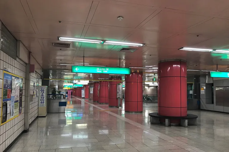
- Yeouinaru Station
- Time needed
- 2–3 hours
Yeouinaru Station Exits 2 and 3 → Yeouido Hangang Park → Mulbit Square
Contents +
A low-pressure Seoul route for a picnic, a flat riverside walk and sunset. Festival days can be exceptionally crowded, so check city notices first.

QUICK ANSWER
The short answer
Start at Yeouinaru Station Exits 2 and 3 and connect Yeouido Hangang Park, Mulbit Square, Mapo Bridge riverside walk. Allow 2–3 hours, but use this question to edit the day: “Use the Han River as shared civic space, with sunset as a deadline rather than the only attraction.” Recheck official opening, reservation and safety notices on the day; In festival crowds or strong wind, keep only a short riverside view and move to an indoor Yeouido stop.
- Start
- Yeouinaru Station Exits 2 and 3
- Allow
- 2–3 hours
- Access time
- Planning estimate; verify the official route
- Route mood
- Yeouinaru: an easy evening beside the Han River
- Core lens
- Use the Han River as shared civic space, with sunset as a deadline rather than the only attraction.
TAKE IT WITH YOU
Turn this guide into a route you can use
Open the stops in Google Maps and keep the Korean place names ready for signs, ticket desks, and local searches.
- Start
- Yeouinaru Station Exits 2 and 3
- Time needed
- 2–3 hours
- Access time
- Planning estimate; verify the official route
START & TRANSPORT
Your first leg and official transport information
Suggested exit & walk
Yeouinaru Station Exits 2 and 3Planning estimate; verify the official routeThe suggested exit may not be the lift exit. With luggage or mobility needs, prioritise the accessible route.The capital-area network has several operators. At an interchange, verify the operator for the line you will actually board.
- 01Yeouinaru Station Exits 2 and 3
- 02Yeouido Hangang Park
- 03Mulbit Square
- 04Mapo Bridge riverside walk
- 05Yeouinaru Station
Last check before you go
Check closures, bookings and weather. With large bags, arrange storage and a collection time before setting out.
Recheck last trains, transfers, works and lift availability.
Check the origin, interchange and destination separately. Maintenance can change the route, so ask station staff for day-of help.
Times vary by line, direction, weekday, weekend and holiday. For a late trip, verify the last possible interchange too.
The map links named places only. Add your chosen restaurant, performance or rest stop separately. Recheck last trains, works and facility outages with the official operator.
CHAPTER 01
Plan backwards from sunset — a Yeouinaru Station field reading
Use the Han River as shared civic space, with sunset as a deadline rather than the only attraction.
Begin with a question rather than a checklist: “Use the Han River as shared civic space, with sunset as a deadline rather than the only attraction.” Work backwards from sunset and the last comfortable return time.
A low-pressure Seoul route for a picnic, a flat riverside walk and sunset. Festival days can be exceptionally crowded, so check city notices first. For a Yeouinaru Station day, read that overview as context and let the conditions you find on arrival decide the exact order.
Yeouido Hangang Park is the first place to test the question. Notice one material, behavior or spatial relationship there before reaching for the camera, and write down what changed your first impression of Yeouido Hangang Park.
CHAPTER 02
Yeouinaru Station field note — Read the shared waterfront
Keep picnic gear outside cycle lanes and emergency access routes.
Slow down at Mulbit Square. Keep picnic gear outside cycle lanes and emergency access routes.
Compare it with Mapo Bridge riverside walk: the contrast between the two matters more than collecting both names. Between Mulbit Square and Mapo Bridge riverside walk, give the place that answers your question more time and shorten the other without treating that choice as a failure.
The overall 2–3 hours allowance for Yeouinaru Station includes pauses and wrong turns. It is not a target to fill here, so leave Mulbit Square early when it has already given you enough evidence.

CHAPTER 03
Choose distance again — the Yeouinaru Station route decision
Convenience stores are often simpler than Korean delivery apps for foreign visitors.
Around Mapo Bridge riverside walk, this part of the Yeouinaru Station route is about movement as much as arrival. Convenience stores are often simpler than Korean delivery apps for foreign visitors.
Between Mapo Bridge riverside walk and Yeouido Hangang Park, crossings, slopes, queues and lift locations can matter more than the distance shown on a map. Recheck the leg to Yeouido Hangang Park at street level before committing to it.
On the Mapo Bridge riverside walk–Yeouido Hangang Park leg, travelers using a wheelchair or stroller, carrying a large case, or managing fatigue should choose the low-obstacle route even when that means skipping the next stop.
CHAPTER 04
Yeouinaru Station: Treat weather as route data
At Yeouido Hangang Park, compare the posted rules with what is actually open and in use.
At Yeouido Hangang Park, read the boundary between visitor space and everyday work. At Yeouido Hangang Park, compare the posted rules with what is actually open and in use.
Around Yeouido Hangang Park, an open door, attractive alley or busy counter does not automatically grant permission to enter, film or block the route. Follow the instructions posted at Yeouido Hangang Park and make room before composing a photograph.
If the place feels crowded, move on quietly to Mulbit Square or take a proper break. For Yeouinaru Station, a shorter visit that leaves residents, workers and other visitors undisturbed is the stronger account of the neighborhood.
CHAPTER 05
Solve everyday friction — a Yeouinaru Station field reading
Before continuing to Mulbit Square, decide which stop can be removed without losing the route’s main question.
Check what can change before building the day around Mulbit Square. Before continuing to Mulbit Square, decide which stop can be removed without losing the route’s main question.
For Mulbit Square, treat opening hours, last admission, reservations, weather controls and event access as separate facts. A dated Yeouinaru Station operator notice and the sign on site outrank an undated search snippet or a travel review.
Save the Korean spellings for Mulbit Square and Yeouinaru Station, plus one short translated question. At Mulbit Square, that small offline note is more useful than assuming an English-speaking staff member will be present.
CHAPTER 06
Yeouinaru Station field note — Make the return the final scene
End with a return route that still works if weather, access or energy changes: In festival crowds or strong wind, keep only a short riverside view and move to an indoor Yeouido stop.
For this Yeouinaru Station itinerary, the final chapter is the route home rather than one more attraction. End with a return route that still works if weather, access or energy changes: In festival crowds or strong wind, keep only a short riverside view and move to an indoor Yeouido stop.
In festival crowds or strong wind, keep only a short riverside view and move to an indoor Yeouido stop. Before leaving Mapo Bridge riverside walk, decide this fallback while you still have battery, daylight and enough energy to reach a familiar station or bus stop without rushing.
On the return to Yeouinaru Station, keep one observation that connects the places rather than a count of completed stops. On this Yeouinaru Station route, that single connection turns a flexible itinerary into a finished trip.
REALISTIC ITINERARY
A decision-led route from Yeouinaru Station
Reassess the next move at every stop instead of trying to fill every minute.
- 00:00Yeouinaru Station Exits 2 and 3
Confirm exit, official status, weather and the route home.
- 01:10Yeouido Hangang Park
Work backwards from sunset and the last comfortable return time. Reassess energy before continuing.
- 02:20Mulbit Square
Keep picnic gear outside cycle lanes and emergency access routes. Reassess energy before continuing.
- 03:30Mapo Bridge riverside walk
Convenience stores are often simpler than Korean delivery apps for foreign visitors. Reassess energy before continuing.
- FinishYeouinaru Station
Return by the safest practical station or stop.
FOR INTERNATIONAL TRAVELERS
Practical checks for international visitors
- Work backwards from sunset and the last comfortable return time.
- Keep picnic gear outside cycle lanes and emergency access routes.
- Convenience stores are often simpler than Korean delivery apps for foreign visitors.
- Keep Yeouinaru Station and the main place name in Korean on an offline screenshot.
- Opening hours, fees and bookings can change; the operator’s dated notice takes priority.
FAQ
Before visiting Yeouinaru Station
What if the main place is closed?
In festival crowds or strong wind, keep only a short riverside view and move to an indoor Yeouido stop.
Check official information (3)
Information checked 2026.09.08
Hours, prices and closures can change. Check the official notice before visiting.
A research-based guide, not a first-hand trip report.
CONTINUE EXPLORING
Continue at the next station
Three next trips selected by comparing city, travel themes, and available time—without simply repeating the same neighborhood.

Mangwon: market lanes to a Han River picnic
Follow a local rhythm from Mangwon Market through residential lanes to the river. The park is about 1.5 km from the station, so adjust for heat, rain and shopping bags.
Dongchon: an evening beside the Geumho River
Compare the old recreation area with today’s riverside exercise and dining while planning for water and darkness.

How not to stop at eating: Gwangjang Market from Jongno 5-ga to Cheonggyecheon
A three-to-four-hour market guide that reads food, textiles, hanbok production, ordering etiquette, Cheonggyecheon, and Heunginjimun as one urban system.